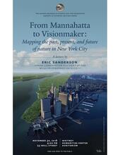
Maps in the 21st century have moved far beyond their hand-drawn, paper-bound antecedents. They are now interconnected ecosystems of computers, datasets, models, websites, primary documents, images, movies, and sound. In this presentation, Eric Sanderson of the Wildlife Conservation Society will discuss how these new and rapidly changing fusions of technology, geography, and history help us see and conceive of the world and the role of human agency within it, through discussion of three kinds of “maps” describing arguably the most altered landscape on Earth, Manhattan island. The first map, developed through the ground-breaking Mannahatta Project, describes Manhattan in the hours immediately prior to Henry Hudson’s arrival in 1609 via over 1600 data layers and associated renderings. The second “map” is a modern composite of the current ecosystems of the city, where buildings, streets, parks, and a surprising amount of remaining forest and wetlands, are fueling critical discussions of what the city should be and what urban life means through a first-ever set of New York City nature goals. Finally, Sanderson will discuss Visionmaker (visionmaker.nyc), a free, online, “map” designed for ecological democracy. Visionmaker.nyc gives all New Yorkers an opportunity to create, test, and share visions of their own neighborhoods, with detailed and comparative evaluations of socio-ecological performance. Such new kinds of maps are critical avenues for people to see, understand, and shape New York, and other cities and locales, in the centuries to come.
